Expert GIS Solutions for Your Business
Specializing in GIS analysis, data transformations, and professional training services.
Get Started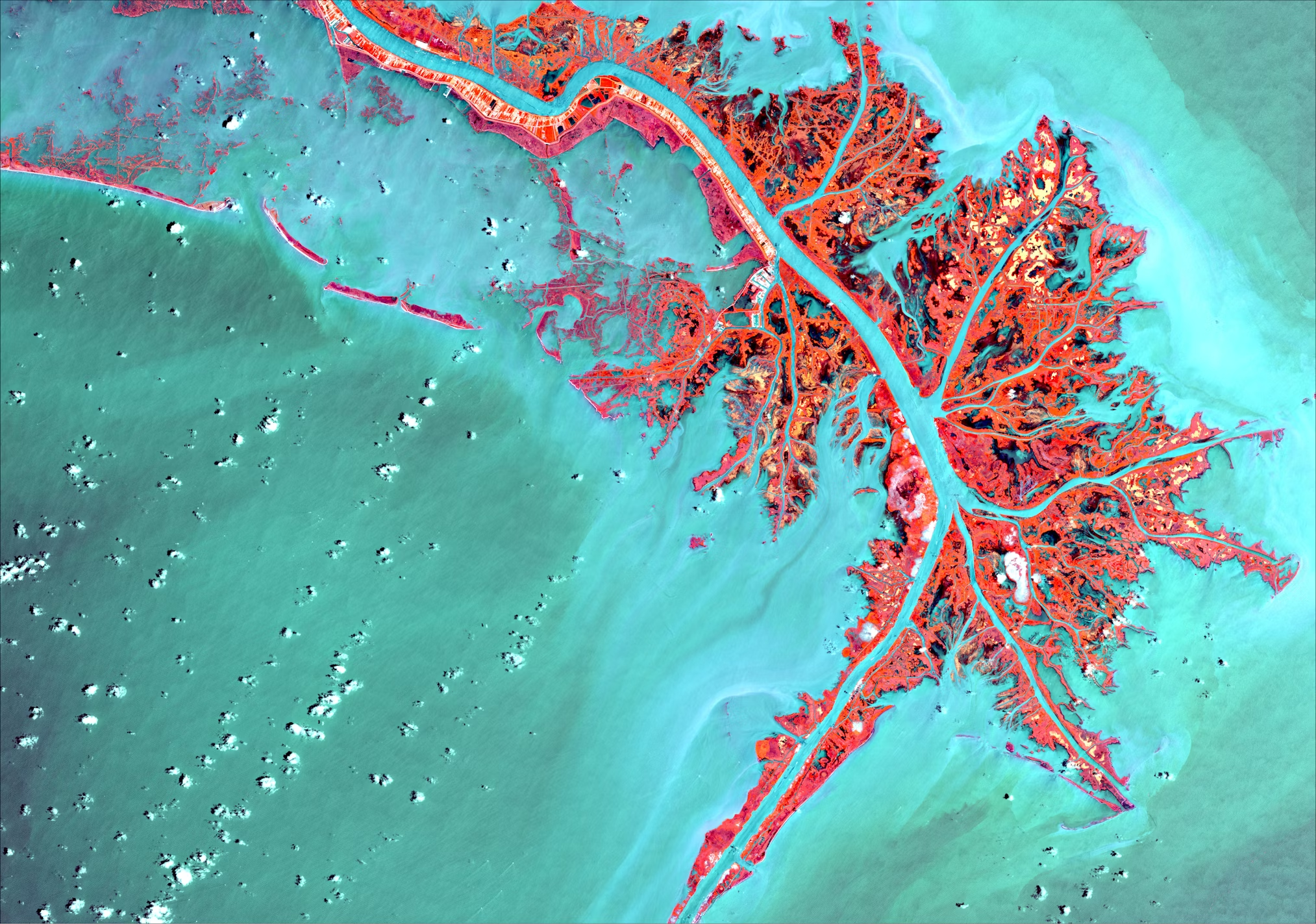
Specializing in GIS analysis, data transformations, and professional training services.
Get Started
Geographic Information Systems (GIS) is a powerful technology that combines spatial data with analytical tools to help organizations make better decisions.
GIS allows you to visualize, analyze, and interpret data to understand relationships, patterns, and trends. It helps answer questions and solve problems by looking at data in a way that is quickly understood and easily shared.
Analyze geographic patterns and relationships in your data. Make informed decisions.
Create compelling maps and visualizations to communicate insights.
Leverage the power of cloud computing with Microsoft Azure for your GIS needs.
Our cloud-based solutions provide scalable, secure, and cost-effective GIS infrastructure. We help you implement and manage Azure-based GIS solutions, including:
Build your team's GIS capabilities with our comprehensive training programs.
We offer professional training in various GIS platforms and technologies, from beginner to advanced levels. Our training programs are designed to help your team:
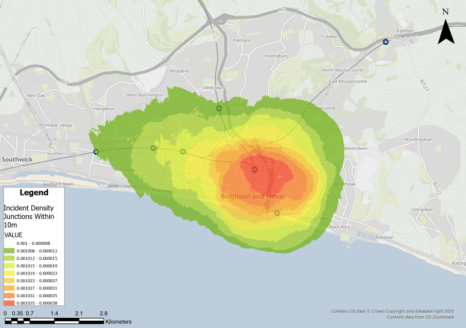
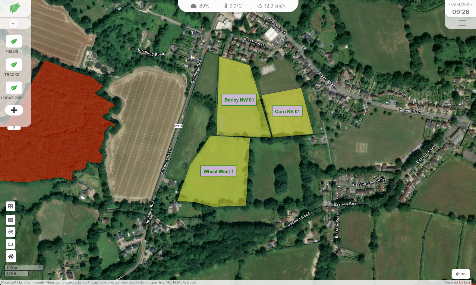
Advanced spatial analysis and data interpretation for informed decision-making including remote sensing, 3D analysis and data types ie LiDAR.
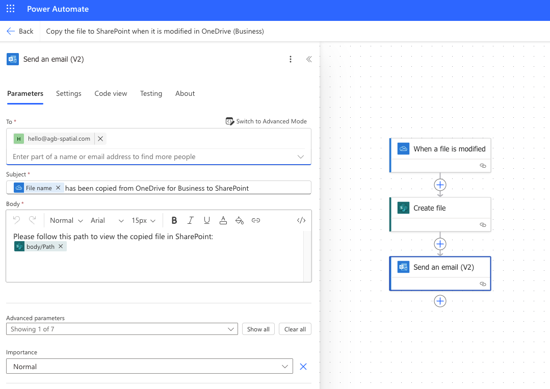
Learn MoreExpert FME Form and Flow solutions, Data Bricks and Power Automate for seamless data integration.
Learn MoreOnSite, Online and Tutor led Professional training in GIS (Theory and Applications), Data Management, ETL (Fme, Power Automate, Data Bricks) and Cloud Technologies (Azure).
Learn More